

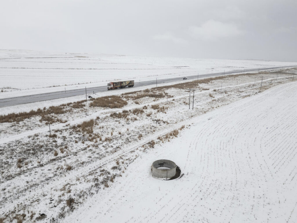
Snow blankets the Drakensberg Gardens north of Underberg in KwaZulu-Natal on Monday 10 August 2026 as one of the most widespread winter snow systems of 2026 sweeps across South Africa. Image: Wikus de Wet
South Africa is experiencing one of its most widespread winter snow events of 2026. The South Africa snow August 2026 system swept across multiple provinces from Sunday 9 August. It brought heavy snowfall, damaging winds and bitterly cold conditions. Furthermore, SAWS issued an orange level 6 warning for disruptive snow over parts of the Eastern Cape. As a result, road authorities, emergency services and communities across several provinces are on high alert.
SAWS confirmed the cold front made landfall over the Western Cape and Northern Cape on Sunday 9 August 2026. The system carried a steep upper-air trough that deepened as it moved east. By Monday 10 August it deepened further over the central and eastern parts of the country. Snow fell in the Drakensberg Gardens north of Underberg in KwaZulu-Natal. Furthermore, the N2 route between Kokstad and Harding was also affected. TrafficSA confirmed and shared images of both locations on Monday morning. As a result, motorists in mountain passes and high-lying areas faced serious travel risks.
The orange level 6 warning covers the Chris Hani District, Senqu, Elundini and Matatiele municipalities in the Eastern Cape. It remains in effect until Tuesday 11 August 2026. SAWS also issued a yellow level 2 warning for disruptive snow across several other Eastern Cape municipalities. Those include Dr Beyers Naudé, Blue Crane, Raymond Mhlaba, Amahlathi, Intsika Yethu, Dr AB Xuma, Mhlontlo and Mzimvubu. Furthermore, the eastern and southern Free State along the Lesotho border and western KwaZulu-Natal are also under snow warnings. As a result, authorities in those areas are on standby and communities are watching road conditions closely.
Wet, very cold and windy conditions are affecting the southern Free State, Northern Cape, Gauteng and Mpumalanga. Snow is possible over mountainous parts of the Eastern Cape and KwaZulu-Natal interior. Furthermore, SAWS issued a yellow level 1 warning for damaging winds between Table Bay and Cape Agulhas from Tuesday morning until Wednesday afternoon. Rough to very rough seas are expected along that stretch of coastline. As a result, the system is hitting both inland and coastal South Africa at the same time.
Forecasters predicted this could be one of the most widespread snow systems of the 2026 winter. Early models suggested snow could fall in every South African province between Sunday and Tuesday. Images and reports from KwaZulu-Natal and the Eastern Cape confirm significant snowfall in those regions. Furthermore, social media filled with photos and videos from communities that rarely see snow in winter. As a result, despite the disruptions and travel warnings, the snowfall has also brought moments of joy to South Africans across several provinces.
Editors Note All weather warnings are based on SAWS advisories and TrafficSA updates published on 10 August 2026. Weather conditions are subject to change.